Laatste geupdate/last update: 9 Feb 2025
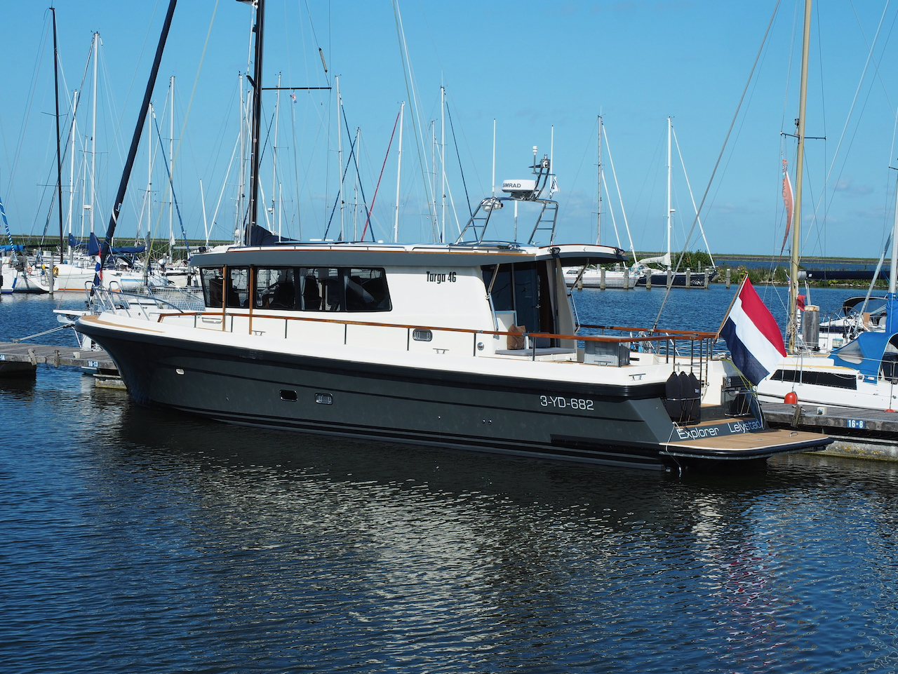
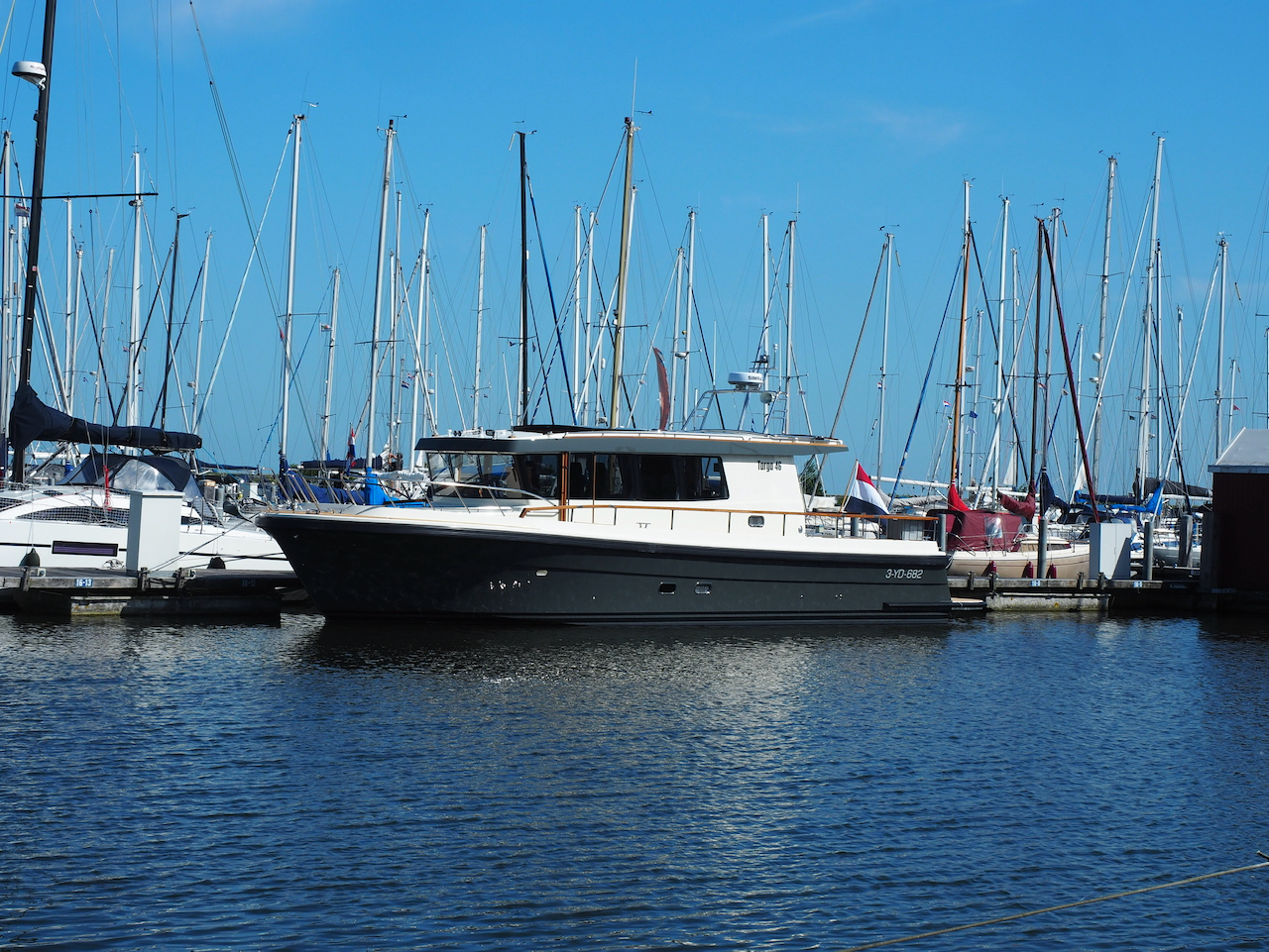
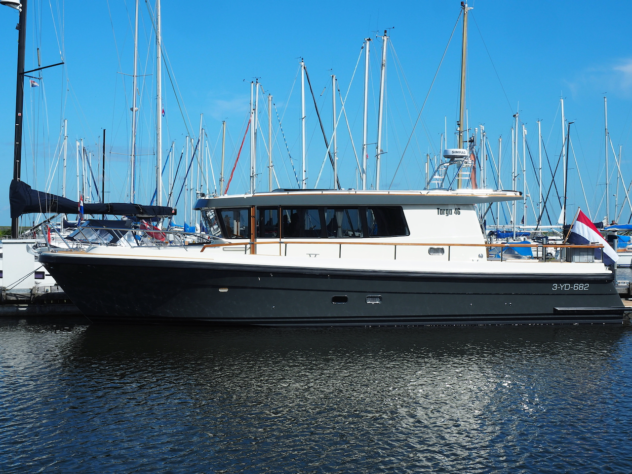
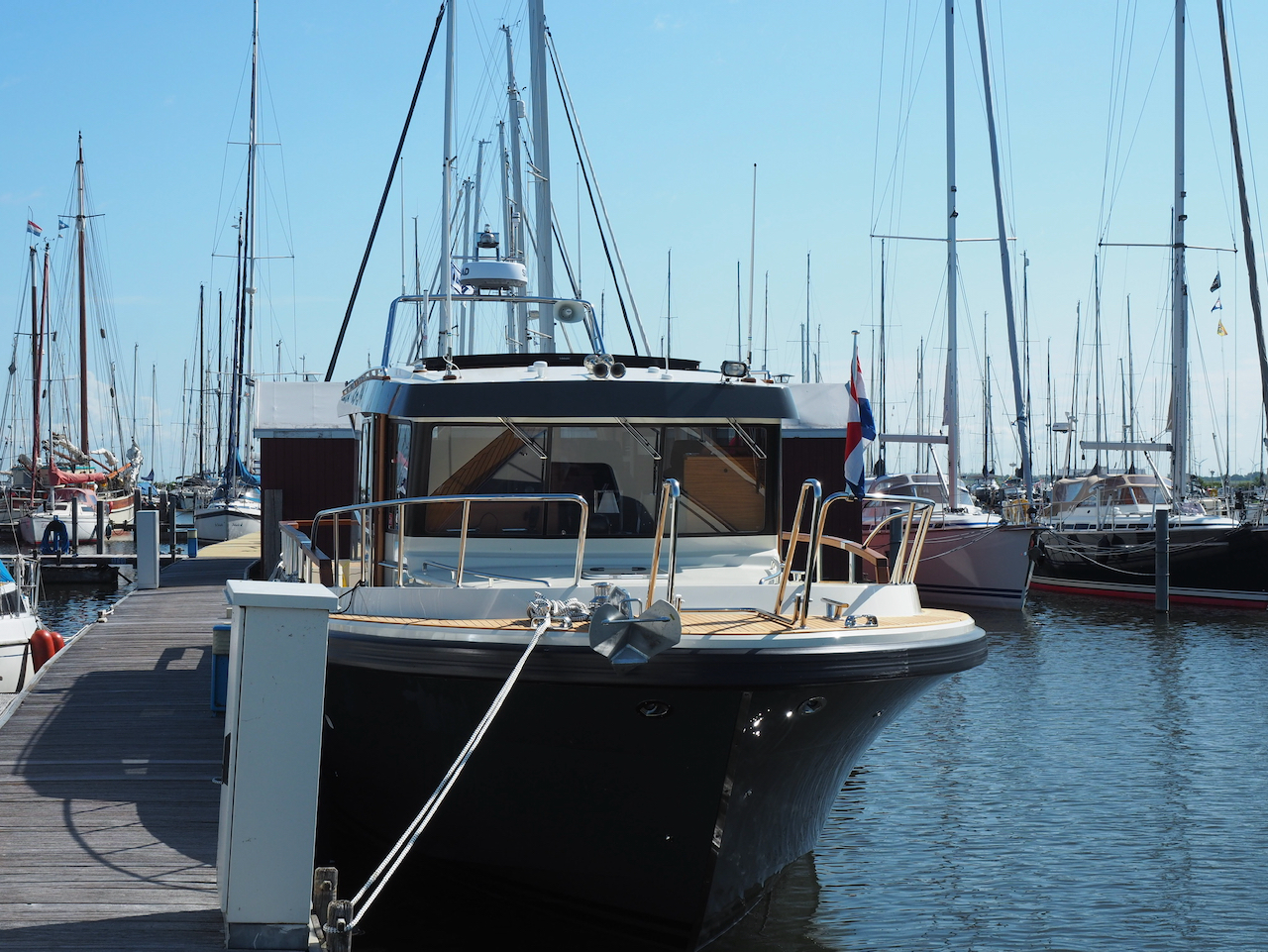
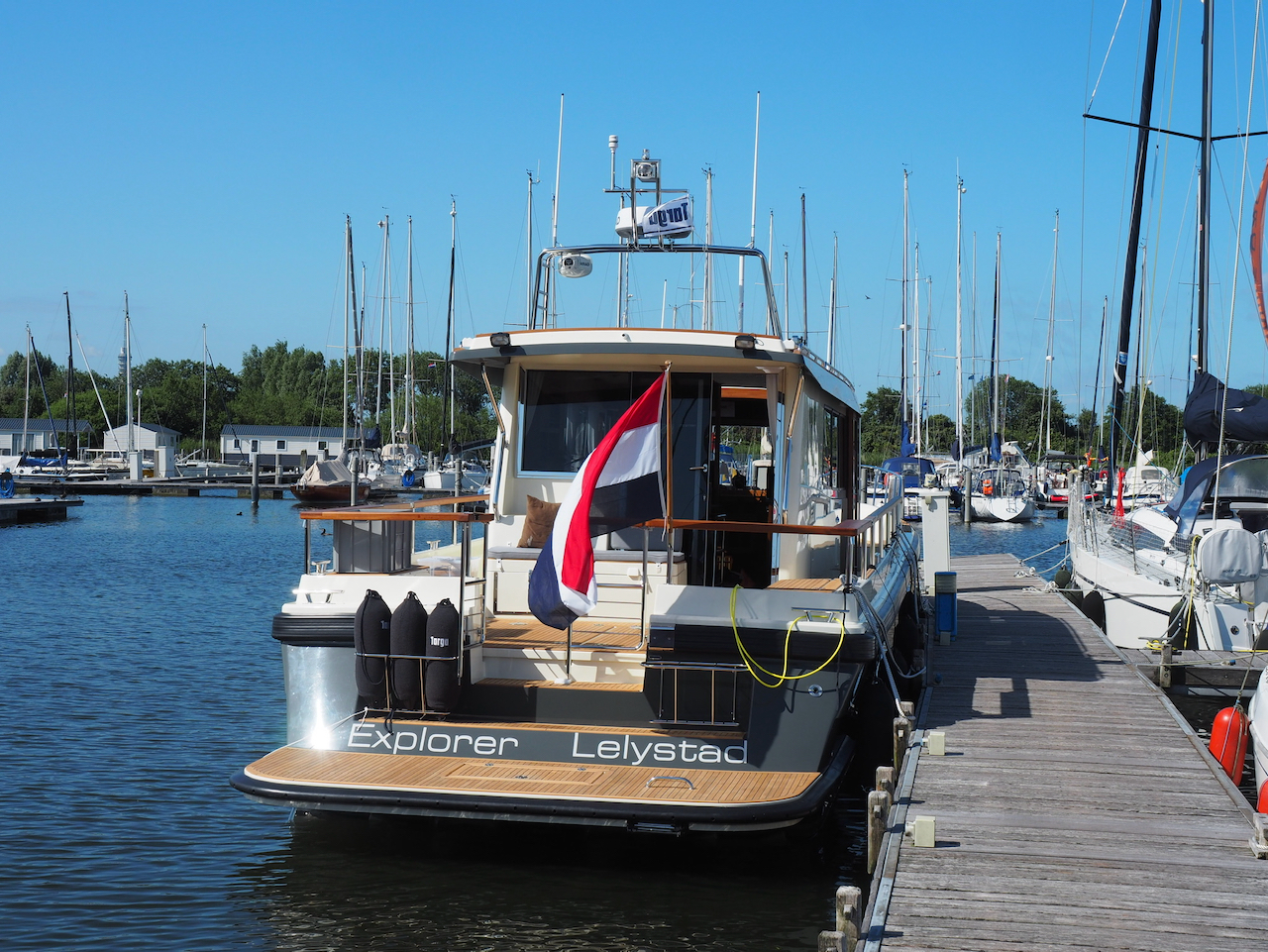
Motorjacht Explorer (NL) / Motoryacht Exlorer (NL)
Specificaties van het schip/specifications of the ship
Merk: Botnia Marin - Finland
Type: Targa 46
Bouwnummer/build number: 038/2020
Bouwjaar/build year: 2020
Kleur: grijze romp, wit (crème) bovenbouw, zwart onder de waterlijn. Teak dek.
Color: hull: heron grey, wheelhouse: off white, hull under the waterline: black. Teak deck.
Rompmateriaal/hull material: polyester
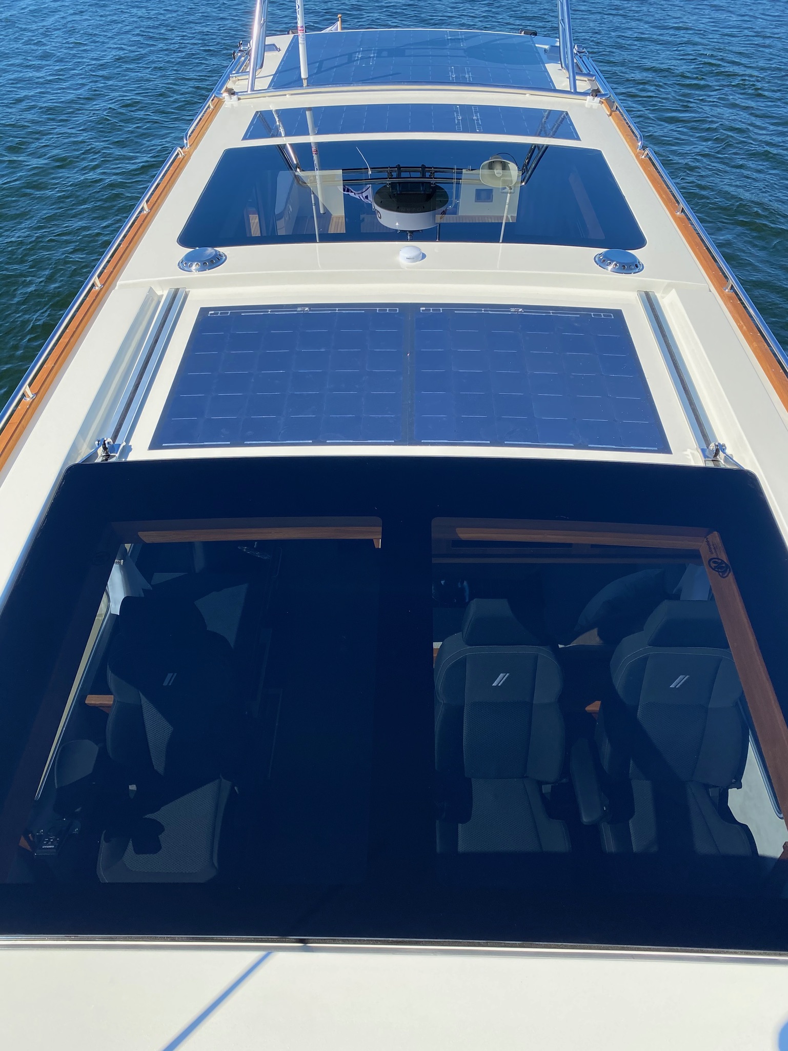
Dak bovenbouw: 2 raampartijen, zonnepanelen op hele dak
Roof of wheelhouse: 2 windows, solar panels on the rest of the roof
Mast: 180 graden hydraulisch klapbare mast met Simrad Radar, twee VHF antennes, luidspreker, weerstation en actieve radarreflector
Mast: 180 degrees hydraulically lowered mast, with Simrad Radar, two VHF Antennas, horn, wheatherstation and active radarreflector
Motoren/engines: 2x Volvo Penta D6-440 DPI met/with z-drives (totaal/total 880 PK/HP)
CE-certificering/CE-certification: B15 of/or C22
Type goedkeuring door/type examined by DNV GL
Fabrikant/Manufacturer: OY Botnia Marin AB, Industrievägen 8, 66100 Malax, Finland; www.targa.fi
Length: 46 foot / 13.93m
Width: 3.93m
Diepgang/draught: 1.10m
Hoogte (air draught): 3.30m (mast plat/mast down), 4.30m (mast omlaag, voorantennes onhoog/mast down front antennas up), 4.70m (mast omhoog, antennes plat/mast down, antennaes down), 5,20m (alles omhoog/all up)
Waterverplaatsing/displacement: 11 ton (leeg/empty)-16 ton (max)
Diesel tanks: 3, totaal/total 1500 liters
Water tank: 1, totaal/total 350 liters.
Registratie/registration
Thuishaven/home port: Lelystad, The Netherlands
Nederlandse vlag, Nederlandse zeebrief - Netherlands flag, Netherlands certificate of registry, SI Vessel ID: 62283
Snelvaart registratienummer RDW/Netherlands high speed vessel registration number on the hull (on both sides): 3-YD-682
Kadaster registratie/ship's registy: 25365 Z 2020
CIN/HIN: starboard side aft: FI-BOM 46038 E 020
Telecommunicatie/telecommunications
VHF met/with DSC: 2 radios
Portofoon/portable VHF: 2 (1 met/with DSC/gps, 1 zonder/without DSC/gps)
Actieve AIS/active AIS
Actieve radarreflector/active radarreflector
MMSI: 244790003
Callsign: PA3736
EPIRB met/with AIS 974120738
EPIRB Hex ID: 1E8581BE60FFBFF
MOB AIS 972126210 en 972125986
Telefoon aan boord/telephone on board the boat (VOIP via Starlink): +31 10 360 28 98
Mobiel eigenaren/mobile owners: +31 652 474 387 en/and +31 642 92 28 25
Satelliet/satellite (emergencies only)
Garmin Inreach Mini 2, IMEI: 300434038136520; serienr/serialno. 78V002600
Satelliet (alleen SMS)/Satellite (only text messages): surf to https://share.garmin.com/targa46explorer ; click on "message", fill out your telephone number for return messages in the format indicated and click on send. The message is then send to our satellite receiver (Garmin Inreach Mini 2). Emergencies only!
E-mail: Dit e-mailadres wordt beveiligd tegen spambots. JavaScript dient ingeschakeld te zijn om het te bekijken.
Inreach address: device-to-device: Dit e-mailadres wordt beveiligd tegen spambots. JavaScript dient ingeschakeld te zijn om het te bekijken.
Starlink: Dit e-mailadres wordt beveiligd tegen spambots. JavaScript dient ingeschakeld te zijn om het te bekijken.
Locatie/location
Huidige locatie kan worden bekeken via Marinetraffic of Vesselfinder als het schip in bereik is van AIS ontvangers.
Current location can be viewed through Marinetraffic or Vesselfinder if the ship is in range of AIS receivers.
https://www.vesselfinder.com/vessels/EXPLORER-IMO-0-MMSI-244790003
Op open zee zullen we via de Garmin Inreach Mini 2 satellietzender de locatie uitzenden in elke 10 minuten. Die kan hier worden bekeken.
On open sea we will have the Garmin Inreach Mini 2 satellite transmitter transmit the location of the ship in 10 mins intervals. This can be viewed here.
https://share.garmin.com/targa46explorer (no password required)
Je kunt de afgelegde route zien en een locatie verzoeken (location knop).
You can view the current track of the yacht and you can request a location (location button).
SafeTRX app: we gebruiken ook de SafeTRX app (KNRM helpt app). Deze werkt ook in de omringende landen zolang er mobiele telefoon of Starlink dekking is.
We also use the SafeTRX app (KNRM version). This app should also work in the surrounding countries as long as we have mobile phone or Starlink connectivity.
Seach-and-rescue
We hebben een SAR contract via Garmin Inreach via my-geos/we have subscribed to a SAR contract with my-geos, through Garmin.
Emergency Operations (IERCC)
+1-936-582-3190
+1-855-444-2937
Crew
Normaliter aan boord/normally on bord: 2 personen, Nederlandse nationaliteit / 2 persons, Netherlands nationality
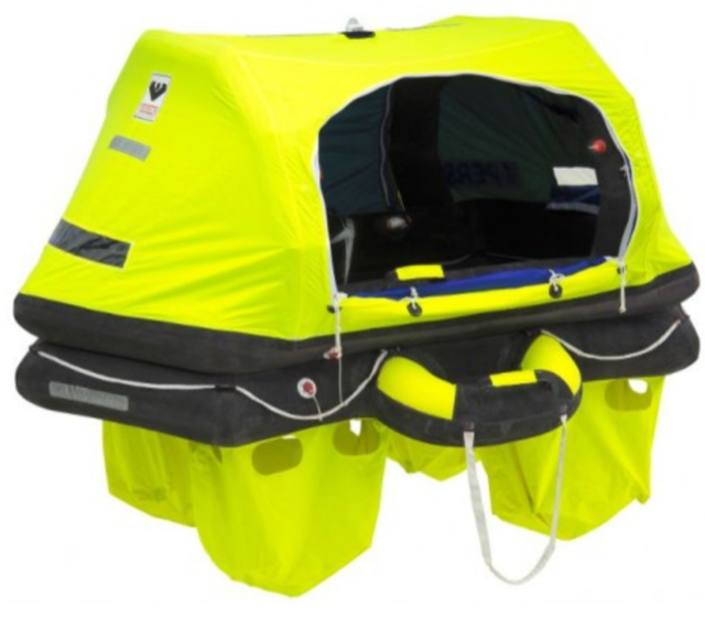
Reddingvlot / liferaft
Merk/brand: Viking
Nr 11632255
Kenmerk op vlot/marking on life raft: 4UKSL
Contact hulpdiensten/Contact emergency services
Kustwacht Nederland/Netherlands Coast Guard: 0900-0111 / +31 88 958 40 40
Andere hulpdiensten op zee/other emergency services on sea: https://sarcontacts.info
SAR; my-GEOS: Emergency Operations (IERCC)
+1-936-582-3190
+1-855-444-2937
Foto's van het schip/pictures of the ship